Year Three/ Four
Communicating with the Year Three/Four Team
We look forward to partnering with you in 2020, and welcome your input:
Mel Rowe (Class 34A) Melinda.Rowe@education.vic.gov.au
Meghan Henchley (Class 34B) Meghan.Henchley@education.vic.gov.au
Melissa Woollard (Class 34C) Melissa.Woollard@education.vic.gov.au

Meghan Henchley
Melinda Rowe
Melissa Woollard
Meghan Henchley
Melinda Rowe
Melissa Woollard
An Overview of our Learning
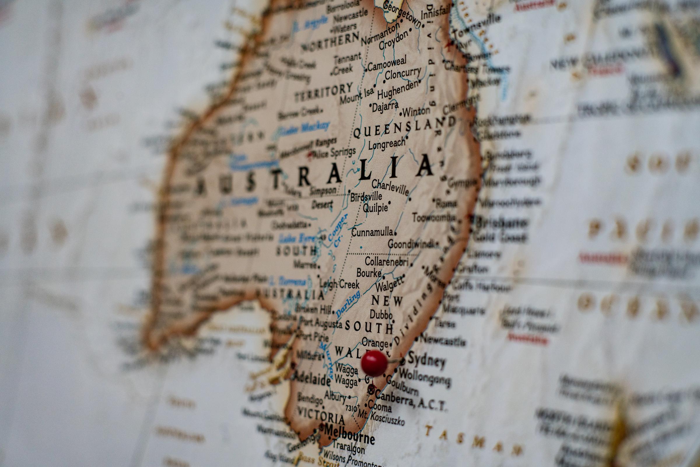
Please see below an overview of the Inquiry Focus for Term Two, during Remote Learning. Unit One Title: My Country (States & Territories) Through Line: Place Learning Area/s: Geography Learning Area: Mathematics – Location & Transformation |
Content: Geography Content Descriptors – Geographical Knowledge Diversity and significance of places and environments
Geography Content Descriptors – Geographical Concepts and Skills Place, space and interconnection
Data and information
Mathematics Content Descriptors – Location and Transformation
Achievement Standards: By the end of Level 4:
Geography – Geographical Knowledge
Geography – Geographical Concepts and Skills
Mathematics
|
Unit One Title: My Country (States & Territories) Through Line: Place |
Themes: Students investigate the representation of Australia as states and territories, as well as Australia’s major natural and human made characteristics. They investigate the human and physical characteristics of other parts of Victoria. Students explore the many countries/places of Aboriginal and Torres Strait Islander peoples throughout Australia. Students locate Australia’s neighbouring countries using maps and globes, and identify the diverse characteristics of these places, including the types of vegetation and native animals. |
Questions: How is Australia represented as states and territories?What are the features (man-made and natural) of these states and territories? How are the many Countries/Places of Aboriginal and Torres Strait Islander peoples throughout Australia represented? What are the custodial responsibilities they have for Country/Place, and how does this influence views about sustainability? What are some of our neighbouring countries? How does our environment different to other places in the world? How can we represent the geographical characteristics of places on simple graphs and maps?
Key Understandings: Representation of Australia as states and territories. How our climate is affected by our place on the Earth. Geographical terms including compass direction, distance and grid references. Representation of places, characteristics and geographical data using tables, simple graphs and maps (including border, scale, legend, title and north point). The many Countries/Places of Aboriginal and Torres Straight Islander peoples throughout Australia. |
Time Allocation: 7 – 8 Weeks (Approximately 330 minutes per week) |