
Comunity update

Prepare for road network changes to keep Fremantle moving during bridge closure
Construction of the new Fremantle Traffic Bridge is making strong progress, with piling now complete and concrete pile caps installed on top of the piles on the southern side of the bridge.
While much of the new bridge can be constructed while the existing crossing is open, it will be necessary to close the bridge to complete the project. This is because the new Fremantle Traffic Bridge is being constructed on the same alignment as the current bridge.
Based on the current timetable, closure of the bridge for up to 12 months is anticipated to begin in early 2026.
This timing reflects feedback from local business representatives and avoids any disruption to road users, businesses and visitors to Fremantle during the busy Christmas period.
Main Roads has undertaken a thorough analysis to determine how best to manage the road network during the closure.
Detailed investigations of the network have involved surveying over 100 intersections. A series of temporary road modifications has been discussed with State and Local Government agencies, including Fremantle Ports, Department of Transport, emergency services, key interest groups and other stakeholders to reduce the impacts of the closure on the travelling public and ensure essential services are able to operate.
Feedback from local schools, business and community groups has also been considered and incorporated where possible.
Modelling shows that the closure of the bridge will have a significant impact on the road network with commuters likely to experience lengthy delays. As a result, some temporary network modifications are essential to keep traffic moving during the closure. We recognise the changes may cause inconvenience and appreciate the community’s patience during the closure period.
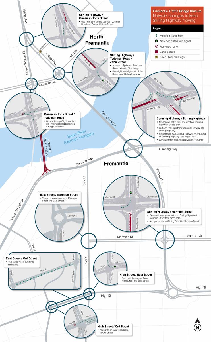
What are the network changes?
The changes include temporary modifications to intersection layouts and extended turning pockets to assist in reducing congestion and keep Stirling Highway moving.
Key locations include the intersections of:
- Stirling Highway and Tydeman Road
- Stirling Highway and Canning Highway
- Stirling Highway and Marmion Street.
Various intersections on High Street west of the Stirling Highway roundabout will also be modified to reduce congestion and cater for additional east-west traffic.
All road modifications are shown on the map below. More details are available on the project website and via our Bridge Closure Fact Sheet.
GETTING IN AND OUT OF FREMANTLE
Main Roads understands the changes to the road network will impact the way people travel to and from Fremantle.
Temporarily prohibiting east and west through traffic on Canning Highway will be critical to reduce congestion on Stirling Highway and means alternative routes will need to be utilised.
A range of upgrades and changes to alternative east-west routes such as Marmion Street and High Street are planned to provide viable alternative access and support the movement of people in and out of Fremantle.
Real time traffic monitoring Throughout the closure, the road network will be closely monitored in real time by the Main Roads’ Road Network Operations Centre. To achieve this, key improvements include: |
|
Working together to help reduce peak time demand State and Local Government agencies are working together to look at ways to reduce demand on the road network during the closure, particularly during the morning and afternoon peak periods. Key considerations include: |
|
More information about these initiatives will be shared with the community in the coming months.
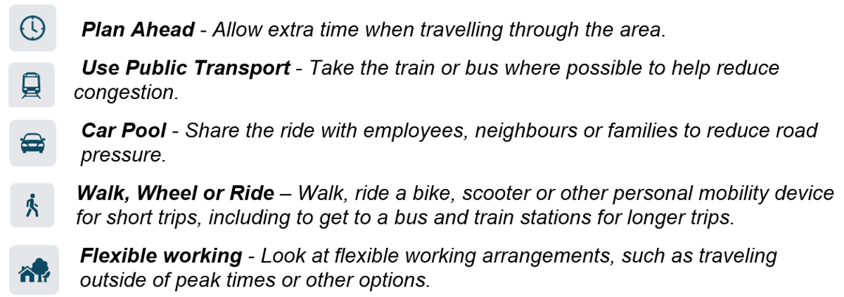
How you can help During the lead up to the closure, we strongly encourage road users to examine how and when they travel through the area. This includes consideration of the mode of travel, route choice, timings of travel, flexible work arrangements and carpooling. |
Survey Reducing vehicle numbers on the network is critical in avoiding severe congestion. We invite you to participate in a quick survey to help us determine:
The survey is available at: www.mysaytransport.wa.gov.au/fremantle-traffic-bridge-closure-travel
What’s next? Changes to the road network will start in late May and continue over the next few months in preparation for bridge closure.
The first change involves the extension of the right turn pocket from Stirling Highway southbound to Marmion Street (to travel to Fremantle). Work is scheduled for late May and will be undertaken at night to minimise impacts to journeys.
More information will be provided to local residents and the broader community through various channels, including Roadworks Updates, briefings, notifications and door knocks to advise when these works will be taking place.
We will be continuing our engagement with businesses, schools, freight operators and community organisations to help prepare for bridge closure. Opportunities include business workshops and pop-up displays in various locations in and around Fremantle, which will be communicated in advance.
|
Further Information Click here to learn more about the Project. For enquiries, please phone 138 138 or email enquiries@mainroads.wa.gov.au. |